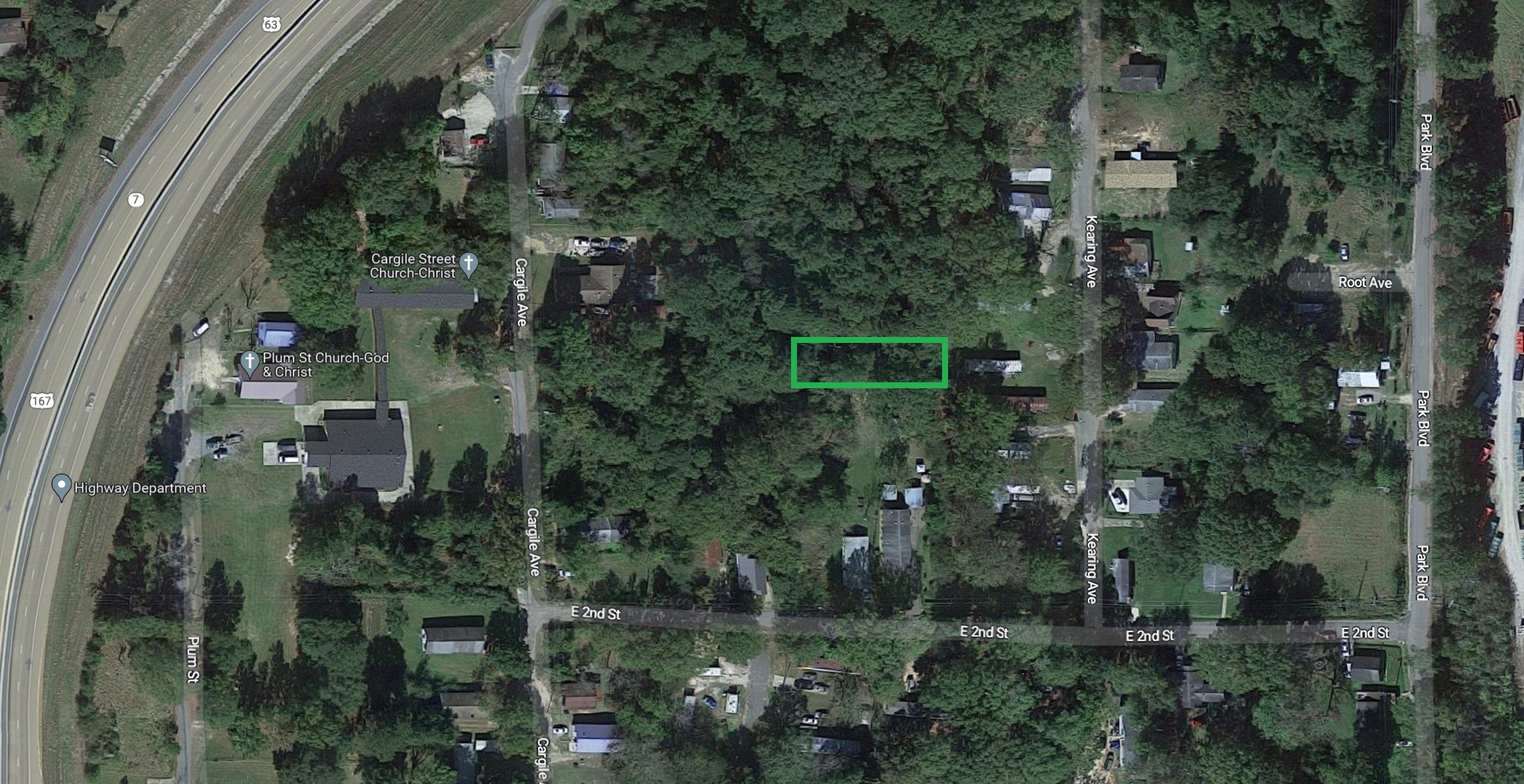
Parcel of land measuring 50x120 in El Dorado, Arkansas.
GPS Coordinates are 33.205533423647644, -92.63814558900503.
- Debit/Credit Cards Accepted
- No Closing Costs
- Cash Price: $950
- Finance with $150 Down and 9 Payments of $115 Per Month
- No Credit Check, No Income Documentation, No Prepayment Penalty
Property Address: 0 Kearing Avenue, El Dorado, AR 71730 (Map location is approximate)
County: Union
Assessor Parcel Number: 04794-00221-0000
Legal Description: Beginning at the Northwest Corner of The Northwest 1/4 of The Northeast 1/4, Thence South 241 Feet, East 440 Feet, South 300 Feet, West 10 Feet for The Point of Beginning. Thence West 120 Feet, North 50 Feet, East 120 Feet, South 50 Feet to The Point of Beginning.
Section: 34 Township: 17S Range: 15W
Zoning: Residential
Annual Property Taxes: $9.00
https://thelotstore.com/property/0-kearing-avenue-el-dorado-ar-71730/?feed_id=12722

Comments
Post a Comment