Spacious unrestricted lot located just outside of Magnolia.
GPS Coordinates are 33.24308709120658, -92.97571913838819.
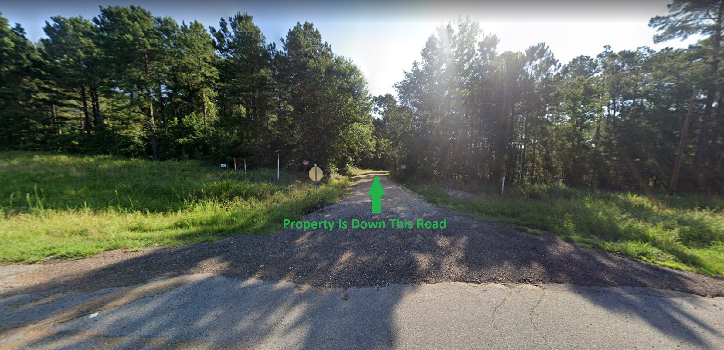
Please Note: Approximate boundary lines are shown based on the metes and bounds legal description.
- Debit/Credit Cards Accepted
- No Closing Costs
- Cash Price: $3,500
- Finance with $300 Down and 36 Payments of $120 Per Month
- No Credit Check, No Income Documentation, No Prepayment Penalty
Property Address: 0 Mount Holley Loop, Magnolia, AR 71753 (Map location is approximate)
County: Union
Assessor Parcel Number: 00000-23595-0400
Legal Description: Commencing at the Southeast Corner of the Northeast Quarter of Northwest Quarter (SEC NE 1/4 NW 1/4) of Section Twenty-one (21), Township Seventeen (17) South, Range Eighteen (18) West and run West 630 feet for point of beginning: This is the Southwest Corner (SWC) of a tract owned by Paul Sanders, as described in Book 588, page 315, Deed Records of Union County, Arkansas; and run thence East 73 feet; thence North 142 feet; thence West 73 feet; thence South 142 feet to point of beginning. Containing 0.24 acres more or less and all located in the Southeast Quarter of Northeast Quarter of Northwest Quarter (SE 1/4 NE 1/4 NW 1/4) of Section Twenty-one (21), Township Seventeen (17 ) South, Range Eighteen (18) West in Union County, Arkansas.
Zoning: None
Annual Property Taxes: $13.00
https://thelotstore.com/property/0-mount-holley-loop-magnolia-ar-71753/?feed_id=29783

Comments
Post a Comment